
Date: 2024-06-30 Page is: DBtxt003.php txt00013756
US Natural Disasters
Forest Fires
Columbia Gorge fire growth slows, but could move east
Burgess COMMENTARY
Peter Burgess
Columbia Gorge fire growth slows, but could move east
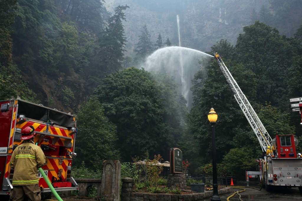
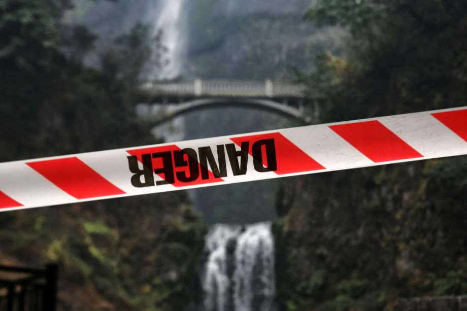 Caution tape blocks the trail to Multnomah Falls as the Eagle Creek Fire continues to burn in the area, Wednesday, Sept 6, 2017, near Troutdale, Or. Fire crews are still working to put out hot spots in the area and protect the historic Multnomah Falls Lodge.
 The Eagle Creek Fire continues to burn on the Oregon side of the Columbia River Gorge near Cascade Locks and the Bridge of the Gods, late Tuesday, Sept. 5, 2017.
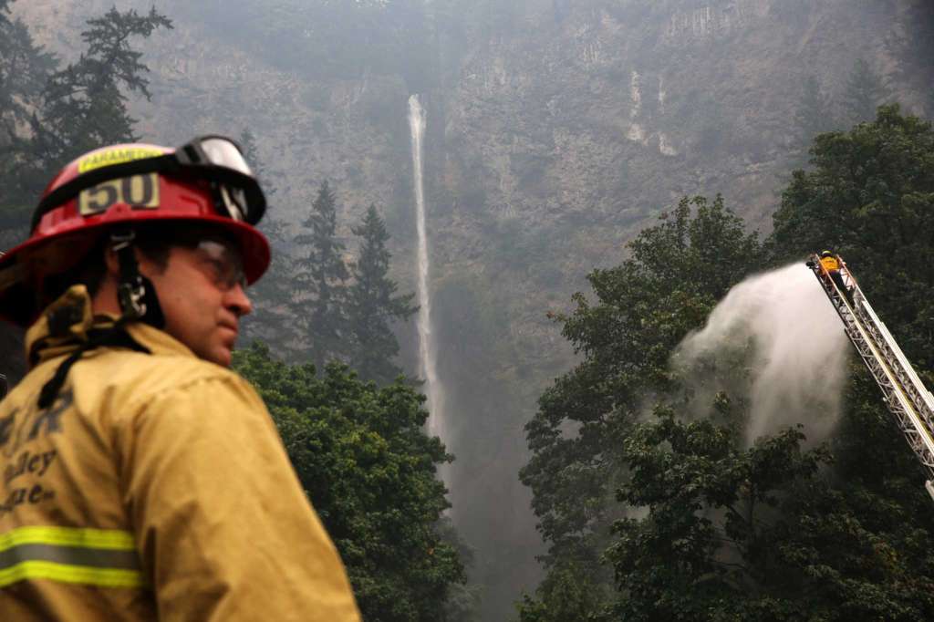
 Firefighters look up towards Multnomah Falls after spending the past days protecting Multnomah Falls Lodge, which was built in 1925, from the Eagle Creek Fire, Wednesday, Sept 6, 2017, near Troutdale, Or. The lodge survived the worst of the fire, but hot spots continue to burn and trees continue to fall from the hills nearby.
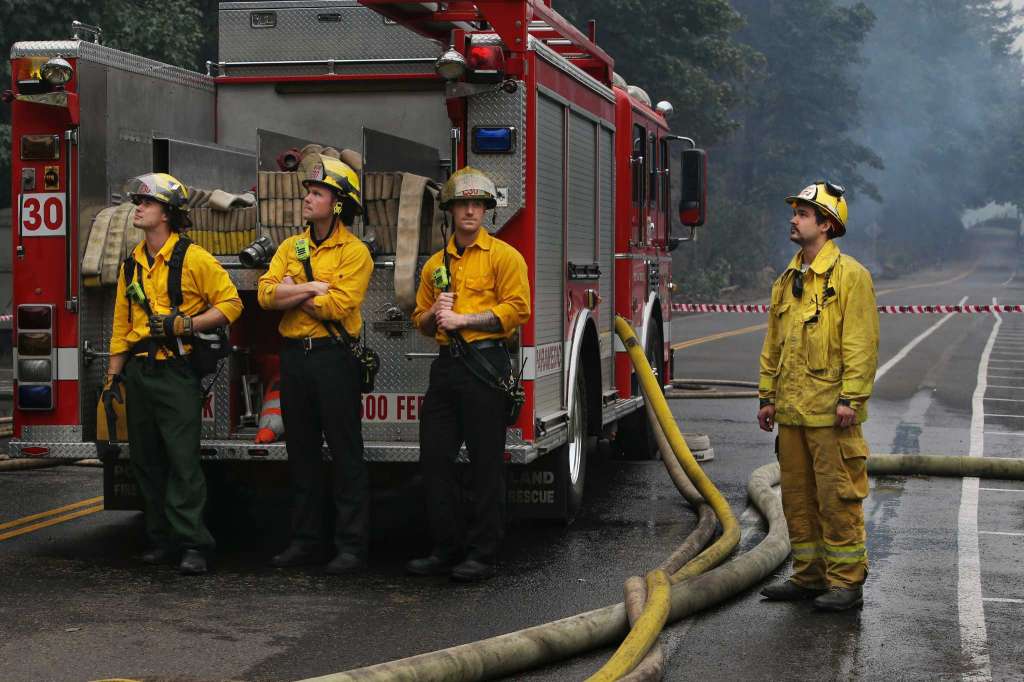
 Fire crews work to protect Multnomah Falls and the Multnomah Falls Lodge, which was built in 1925, from the Eagle Creek Fire, Wednesday, Sept 6, 2017, near Troutdale, Or
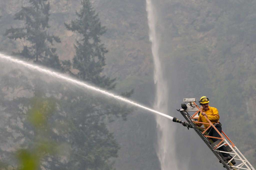 Fire crews work to protect Multnomah Falls and the Multnomah Falls Lodge, which was built in 1925, from the Eagle Creek Fire, Wednesday, Sept 6, 2017, near Troutdale, Or.
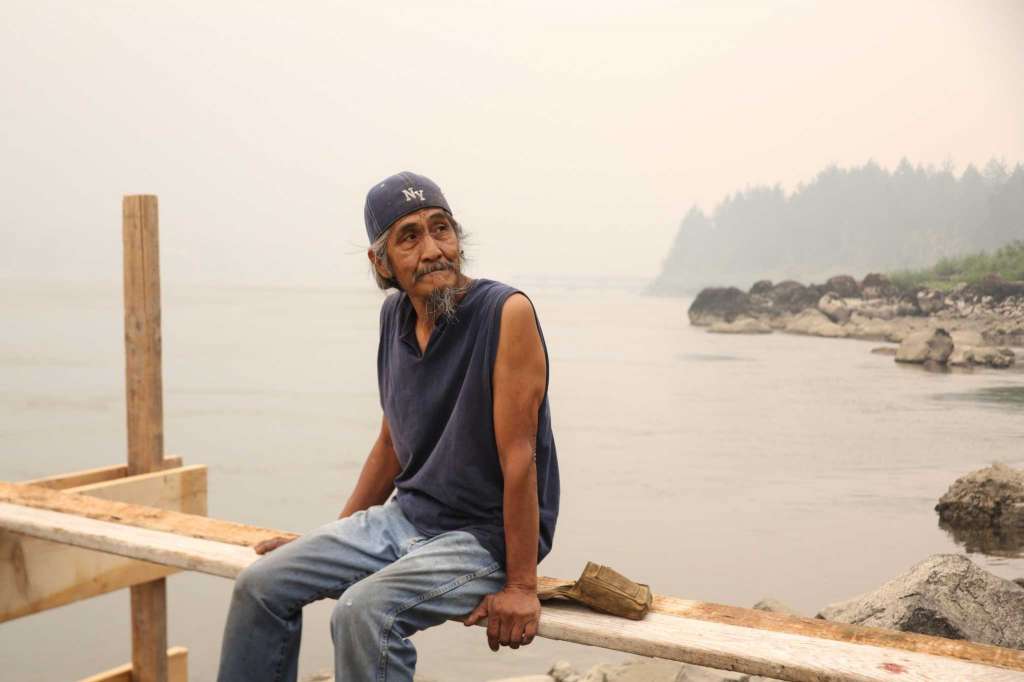 Bill George takes a break from building a fishing stand to look out at the Columbia River Gorge that filled with smoke from the Eagle Creek and Archer Mountain fires, Wednesday, Sept. 6, 2017. George is from Yakima, but comes to the Columbia River often to fish for salmon. He worries that many of the fish will die because the ash and fire heat up the river.
 Fire crews work to protect Multnomah Falls and the Multnomah Falls Lodge, which was built in 1925, from the Eagle Creek Fire, Wednesday, Sept 6, 2017, near Troutdale, Or. The lodge survived the worst of the fire, but hot spots continue to burn and trees continue to fall from the hills nearby.
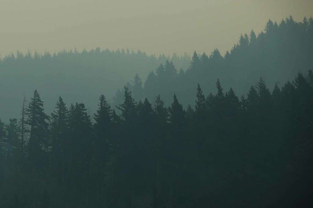 Smoke from the Eagle Creek fire continues to fill the usually clear Columbia Gorge, Wednesday, Sept 6, 2017, near Troutdale, Or.
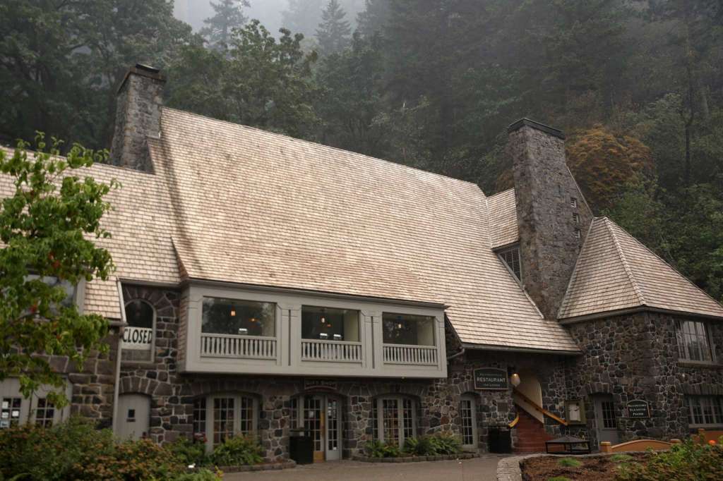 he Multnomah Falls Lodge, built in 1925, remains unscathed after fire crews worked for two days to protect it from the Eagle Creek Fire, Wednesday, Sept 6, 2017, near Troutdale, Or. The lodge survived the worst of the fire, but hot spots continue to burn and trees continue to fall from the hills nearby.


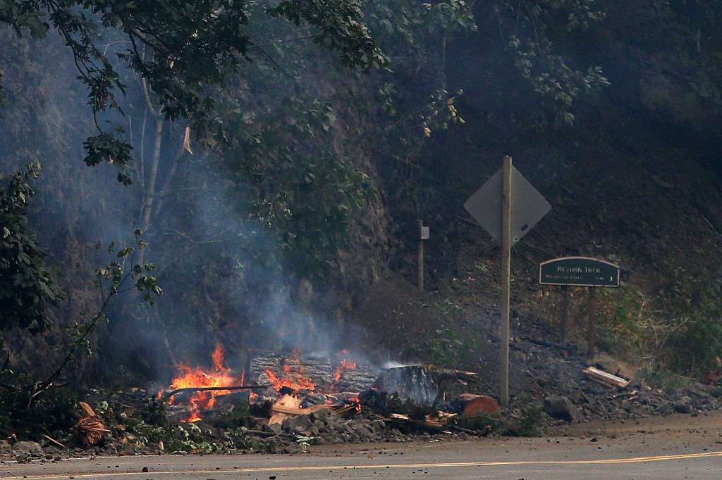 Debris burns on the side of the Historic Columbia River Highway near Multnomah Falls, Wednesday, Sept 6, 2017, near Troutdale, Or. The Eagle Creek Fire has now consumed over 30,000 acres.


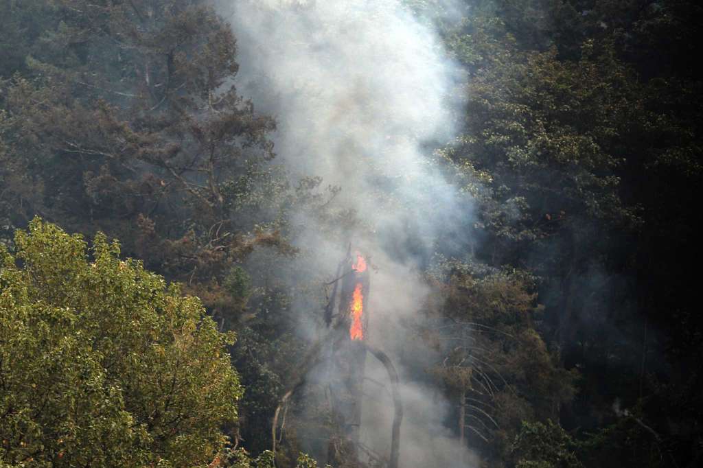 A tree burns from the inside out due to the Eagle Creek Fire Wednesday, Sept 6, 2017, near Troutdale, Or.
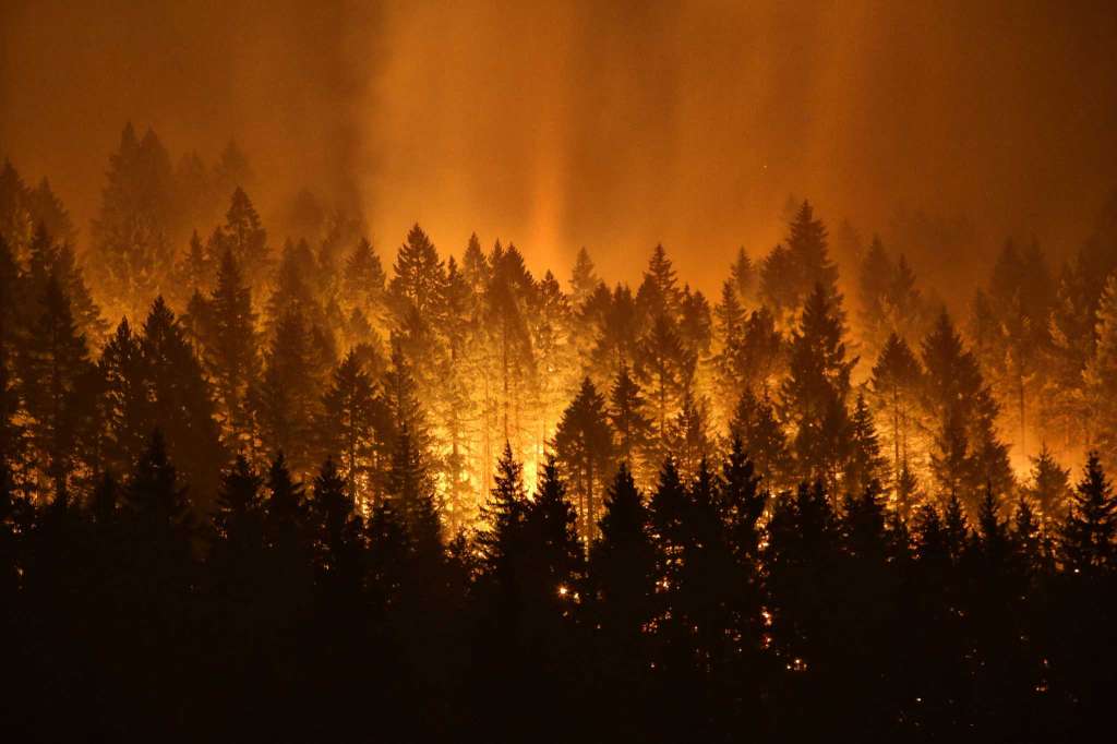
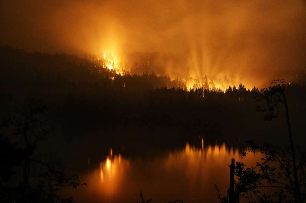
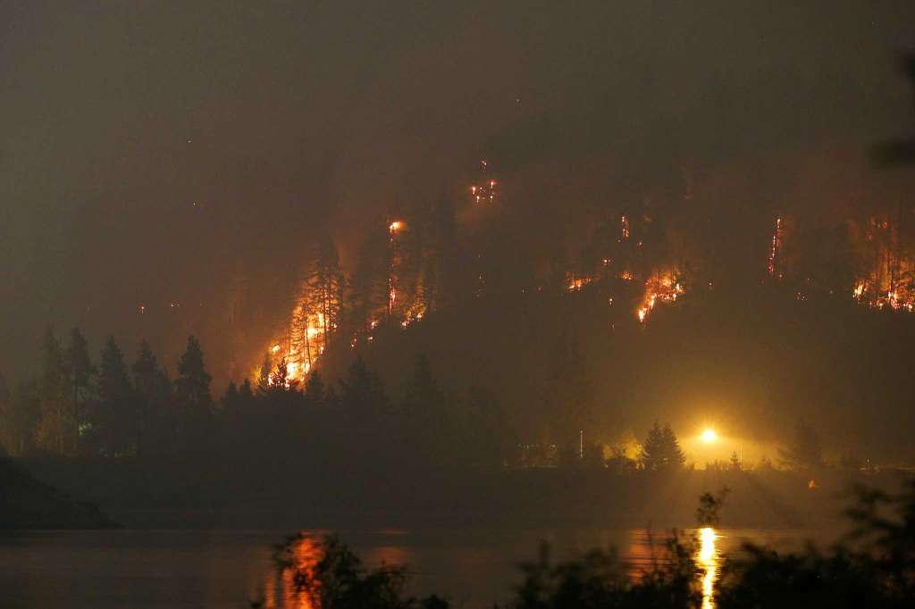 The Eagle Creek Fire lights up a hillside on the Oregon side of the Columbia River Gorge near Cascade Locks and the Bridge of the Gods, Tuesday night, Sept. 5, 2017. Genna Martin, seattlepi.com)


 The Eagle Creek Fire continues to burn on the Oregon side of the Columbia River Gorge near Cascade Locks and the Bridge of the Gods, late Tuesday, Sept. 5, 2017.


Caution tape blocks the trail to Multnomah Falls as the Eagle Creek Fire continues to burn in the area, Wednesday, Sept 6, 2017, near Troutdale, Or. Fire crews are still working to put out hot spots in the area and protect the historic Multnomah Falls Lodge. Photo: GENNA MARTIN, SEATTLEPI.COM / SEATTLEPI.COM
Photo: GENNA MARTIN, SEATTLEPI.COM
IMAGE 52 OF 59 This natural-color satellite image collected by NASA's Suomi platform on Sept. 4, 2017, shows wildfires in the Pacific Northwest, California, Idaho and Montana. Actively burning areas are outlined in red.IMAGE 1 OF 59 Caution tape blocks the trail to Multnomah Falls as the Eagle Creek Fire continues to burn in the area, Wednesday, Sept 6, 2017, near Troutdale, Or. Fire crews are still working to put out hot spots in the area and protect the historic Multnomah Falls Lodge.
A wildfire burning in the Columbia River Gorge about 40 miles east of Portland measured more than 52 square miles Thursday, and kept more than 1,800 people out of their homes as firefighters worked to get some control of the blaze.
The fire had grown roughly 3,000 acres Wednesday -- to a total of 33,382 acres -- and the connected fire burning across the river near Archer Mountain was up to 150 acres, according to Matt Ehrman, a public information officer with the Columbia River Gorge National Scenic Area.
By Thursday morning, firefighters had the fire about 5 percent contained, according to an update posted to InciWeb.
With some control on the fire, the U.S. Coast Guard reopened the Columbia River to commercial traffic at night, but Interstate 84 remained closed from Troutdale to Hood River.
Falling rocks, trees and other debris were a threat on the highway, and the Oregon Department of Transportation said it would need to fell about 2,000 hazardous trees before the route could be reopened, according to a Thursday news release.
Union Pacific trains once again moved through the gorge Wednesday as well.
Westerly winds were expected to keep up Thursday, with the potential to push the fire east, and the National Weather Service had a red flag warning in effect for the area. Thunderstorms were also in the forecast, though the potential for rain to follow could dampen fire growth.
A handful of homes on the Washington side of the Columbia, near Archer Mountain, remained under evacuation orders. A Washington Department of Natural Resources team took over management of that fire Wednesday.
Wednesday night, firefighters worked on fire lines near Cascade Locks and Bridal Veil and battled several spot fires, including one around around 4 a.m. near a cell tower, according to the release. All those fires were within secondary contingency lines, and firefighters worked to douse them and keep them within those lines.
Through Wednesday morning, one unused home and four outbuildings had been confirmed as burned by the fire.
Oregon Gov. Kate Brown, speaking at a Wednesday afternoon media briefing at the historic Multnomah Falls lodge, was hopeful about the change in winds and lessened fire activity.
'We are moving from a defensive posture to an offensive posture,' she told gathered media. '(Our) goal is to get the fire contained and get folks back into their homes as fast as possible.'
SEE BELOW FOR FULL EVACUATION INFORMATION
The Eagle Creek fire started Saturday and grew to more than 3,000 acres overnight. But easterly winds fanned flames Monday and the fire exploded overnight.
The fire's size Thursday equaled more than half the square mileage of the city of Seattle.
The fire burned so rapidly Monday night that officials were still sorting out what exactly had happened by Tuesday afternoon.
'It did catch us by surprise how much it grew last night,' said Joanie Schmidgall, public information officer with Pacific Northwest Incident Management Team 6, on Tuesday. 'The evacuations were happening so fast last night it was even hard for us to keep track of them.'
Authorities said they believed the fire was started by a 15-year-old boy and his friends lighting illegal fireworks on a trail. No arrests had been made by Tuesday evening.
Brown advised Wednesday afternoon that tourists hoping to travel to the Columbia Gorge change their plans and head for the coast or elsewhere in the state.
Firefighters from the Oregon Fire Marshal's office had spent Monday night protecting the lodge at Multnomah Falls, a building that dates to 1925. But even so, Brown couldn't estimate when visitors might be able to return to the site, one of the most popular destinations in the gorge.
Brown had said at a media briefing Tuesday that officials were also worried about potential impacts to the Bonneville power grid, according to a report by the Oregonian.
'Obviously our top priority is to protect Oregonians and public safety, and of course Washingtonians as well,' she said. 'Second, critical infrastructure.'
Evacuees were being routed to Hood River Community College in Gresham, just east of Portland, and to the Skamania County Fairgrounds in Stevenson, Washington.
Gloria Howell, who lives across the street from the Skamania fairgrounds, said she had seen the families crowding into the space from Cascade Locks and elsewhere evacuation notices were in effect.
Interstate 84 remained closed Wednesday from Troutdale to Hood River, pushing all the east-west traffic to the north side of the river in Washington, along state Route 14.
'I got up at 5 a.m. and I looked out my window and I couldn't believe the cars going by,' Howell said.
She said she had heard of the 'usual things' like gas stations running out of fuel as the area became crowded with evacuees and traffic. The area was hazy with smoke and falling ash Tuesday evening, and people had spent the day preparing their homes: cleaning out gutters, turning on sprinklers and clearing dry grass away from buildings, she added.
The fire had made nearly unheard of runs Monday night, burning 13 miles in 16 hours according to one report, and images showed the magnitude of the fiery blaze.
Howell and her husband sat outside until after 11:30 Monday night watching the fire climb up ridges on the other side of the river.
'It's really a shame, to see that,' she said.
In Portland, residents were covered in ash and shrouded in a smoky haze carried east from the fire.
Easterly winds were expected to keep up into Tuesday evening before reversing in the night to coming out of the west. That reversal could cause the fire to grow to the east, though likely not like what it had Monday night, Schmidgall said.
'It can still grow,' she warned.
Schmidgall said officials had asked for a type 1 incident management team, an indicator of the size and danger of the fire. But getting more resources may be tough as teams are spread thin across fires swallowing up much of the West.
The National Interagency Fire Center in Boise, Idaho, a federal agency that coordinates wildfire-fighting, said 80 large fires were burning on 2,200 square miles in nine Western states.
In Washington alone, fires were burning across nearly 200,000 acres -- more than 300 square miles -- and at least two were demanding heavy resources as those fires also burned close to homes and people.
Residents in the area should contact the Hood River County, Multnomah County or Skamania County sheriffs offices for detailed evacuation information.
Here are the areas under evacuation notice for the Eagle Creek fire, per InciWeb:
'The Multnomah County Sheriff's Office has issued Level 3 (Go!) evacuations for Larch Mountain and the communities of Dodson, Warrendale, Latourell, Bridal Veil, and East Corbett. Corbett and Springdale are under a Level 2 (Be Ready) evacuation status. An evacuation shelter has been established at Mt. Hood Community College, located at 3691 NE 17th Drive, Gresham, OR.
The Hood River County Sheriff upgraded all Level 1 (Get Ready) notices in Cascade Locks to Level 2 (Get Set). This includes all areas north of Wa Na Pa to the Columbia River and on the east end of town north of I-84 to the river, as well as Forest Lane and intersecting roads, running east to Government Cove. Level 3 (Go!) evacuation notice is in place for everything south of I-84 in Cascade Locks. A Red Cross Shelter has been set up at the Skamania County Fairgrounds, immediately across the Columbia River in Stevenson, Washington.
Due to fire activity Archer in Skamania County, Washington, the following evacuation levels are in place: Level 3 (Go!) for Archer Mountain Road- Smith Crops- Deville Road. Mabee Mines Road is under a Level 2 (Get Set) evacuation notice. For information regarding evacuations in Skamania County, please contact the Skamania County Emergency Operations Center at 509-427-8076. This fire is being managed by Washington State Department of Natural Resources.'
SeattlePI staff photographer Genna Martin and The Associated Press contributed to this report.
Daniel DeMay covers Seattle culture, city hall, and transportation for seattlepi.com. He can be reached at 206-448-8362 or danieldemay@seattlepi.com. Follow him on Twitter: @Daniel_DeMay.
=========================================================================
RELATED: Central Wash. wildfires shroud Seattle in ash, smoke
RELATED: Norse Peak fire threatens Crystal Mountain, Jolly Mtn. fire grows
Next Up
Eagle Creek fire obscures Columbia River gorge in smoke
00:28
00:29
Smoke hangs heavy in the Columbia River Gorge as Eagle...
seattlepi
Now Playing
Timelapse Video: Wildfire Spreads Near Portland...
AP
Eagle Creek fire obscures Columbia River gorge in smoke...
seattlepi
Columbia Gorge wildfire
Media: Seattle Post-Intelligencer